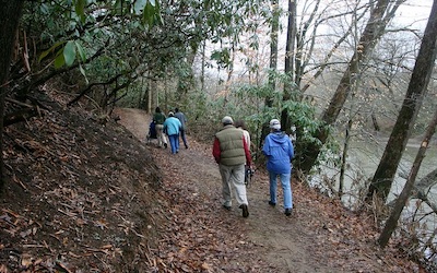
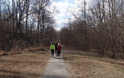
Trails - Virginia
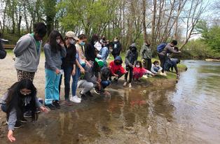
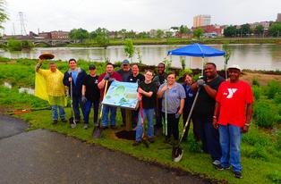
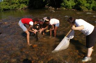
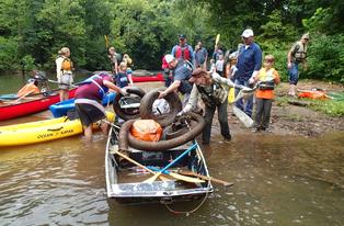
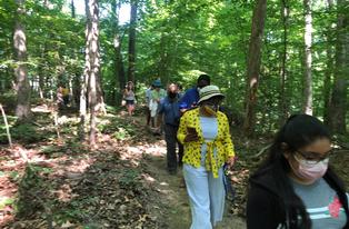
Working with local governments, community organizations and businesses, we help create and maintain hiking and biking trails, river walks and greenways, safe and attractive locations for healthful exercise, and opportunities for children and adults to learn about animals and plants that live and grow here.
In the Henry County and City of Martinsville area of Virginia, DRBA's affiliate, the Martinsville-Henry County Rivers and Trails Group, is active in a number of different projects. In Patrick County, DRBA's Patrick County Rivers and Trails Group is working to develop a Master Recreation Plan for the County.
Martinsville/Henry County
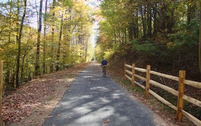
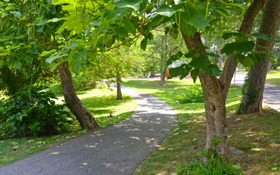
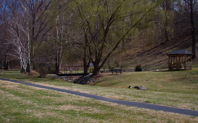
Dick & Willie Passage
 Martinsville/Henry County, VA
Type of Trail: Multi-Use
Length: 4.5 miles
Trail Head(s) Directions:
The Dick and Willie Passage Trail begins at Virginia Avenue and ends near Mulberry Creek in Martinsville/Henry County. The trail can be accessed at four different locations: Virginia Avenue, Liberty Street, Doyle Street and Fisher Street. It is a beautiful 4.5 mile paved rail trail that accommodates walking, running, biking and rollerblading. If you would like to bike, bicycles and helmets are available for check out at Activate Martinsville/Henry County at the Doyle Street trailhead.
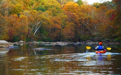
Fieldale Trail & Canoe Access
 Fieldale, VA
Type of Trail: Multi-Use
Length: 2.5 miles
Trail Head(s) Directions:
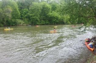
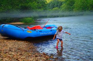
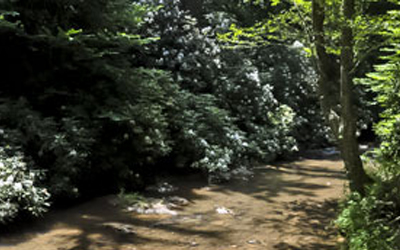
The Fieldale Trail and Canoe Access is a 2.5 mile trail that follows along the Smith River passing sites of historic Native American culture and remnants of Fieldale and Kohler's industrial past. It also has a Canoe Access for you to launch your canoe.
Gravely Nature Preserve
 Ridgeway, VA
Type of Trail: Multi-Use
Length: 2.5 Miles
Trail Head(s) Directions:
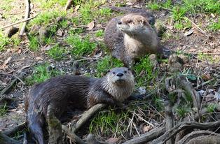
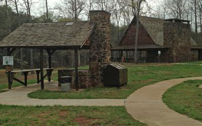
The 75-acre Gravely Nature Preserve is located in southern Henry County in Ridgeway, VA off Eggleston Falls Road. The loop trails are unpaved and completely surrounded by forested land, primarily with mature hardwoods. It is a great place to walk, hike, run, or bike. There are opportunities is see many different kinds of wildlife including deer, a variety of birds and butterflies, foxes, groundhogs, and much more. The property also has two century-old tobacco barns, the Burgess family cemetery, and remnants of old logging roads. A map and brochure are at the trailhead.
Lauren Mountain Preserve
 Bassett, VA
Type of Trail: Multi-use
Length: 1.5 miles
Trail Head(s) Directions:
Lauren Mountain Preserve is a 1.5 mile out an back trail that follows the Smith River and is located in Bassett, VA on Wells Hollow Road. This beautiful trail has a wide variety of plant life and wonderful views of the smith river. It is a great experience for hikers and fishermen
Mountain Laurel Trails
 Ridgeway, VA
Type of Trail: Multi-Use
Length: Approximately 7 Miles
Trail Head(s) Directions:
Close to 7 miles of hand and machine constructed single track trails are almost complete and based on a stacked-loop design with plans for up to 15. The 4 mile Central Loop is the “core” trail that all other optional trails are connected. Many of the trails border creeks and water while others meander through the woods or ridge-tops.
These trails were specifically designed to appeal to all skill levels, beginner to advanced. It remains a work-in-progress, with signage, maps, parking lot facilities, on site camping information boards and optional technical trail features like skinnys and rock gardens that provide a challenge. For more info,click here.
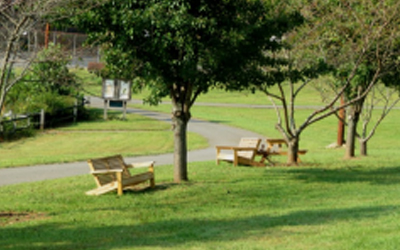
PHCC Loop Trail
 Martinsville, VA
Type Of Trail: Walking and Biking
Length: 2/3 miles
Trail Head(s) Directions:
Patrick Henry Community College Loop Trail follows the edge of the reservoir is 2/3 miles long located in Martinsville, VA. It is a great trail for wonderful plant life. It also offers great lake views, benches, and picnic areas to sit. You can also take a middle tail along the ride to its intersection with the loop trail at the tip of the peninsula.
Philpott Dam Greenway Trail
Bassett, VA
Type of Trail: Multi-Use
Length: 4.5 miles
Trail Head Directions:
Rock Ridge Trail
 Martinsville, VA
Type of Trail: Multi-Use
Length:1.2 miles
Trail Head(s) Directions: Rock Ridge Trail is a beautiful trail that will take you through a hardwood forest and numerous rock outcroppings down tot he lake shore and looping back again through the woods to the parking area. On the other side of the entrance road, the trail winds down the ride to the edge of the lake. The trail compliments the PHCC loop trail which is located across the lake near the Frith Building parking lot.
 Silverbell Trail
Martinsville , VA
Type of Trail: Multi-Use
Length: 0.25 miles
Trail Head(s) Directions:
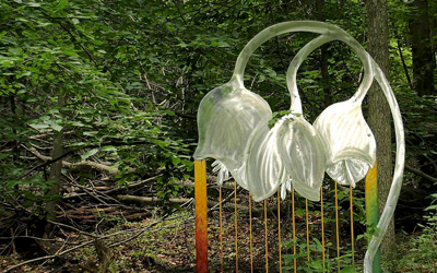
Silverbell Trail is a quarter mile trail that takes you through lovely wooded areas. It was named after the Carolina Silver bell tree. It is located in Martinsville, VA on the corner of Church and Oakdale Streets. It has wonderful ironwork sculptures at the end of each trail that you may enjoy as you walk.
Smith River Fieldale Trail
 Fieldale, VA
Type of Trail: Multi-Use
Length: 6 miles
Trail Head(s) Directions:
The Smith River Fieldale Trail starts at 3521 South River Road, Fieldale, VA. It offers 6 miles of unpaved walking trail, out and back. The trail was designed for walking, running, and biking. Along the trail there are river access points for launching kayaks, canoes, or boats. There are opportunities to see many different types of wildlife including wildflowers, deer, groundhogs, squirrels, geese, birds and butterflies. Ample parking, picnic tables, and restroom facilities are available at the trailhead. This is a great trail to enjoy with the whole family!
Textile Heritage Trail
 Fieldale, VA
Type of Trail: Multi-Use
Length: 2.4 miles
Trail Head(s) Directions:
The Fieldale walking trail can be accessed midway at the Fieldale Trailhead or The Textile Heritage Trail near Fieldale park. It has a river access points and parks designed for outdoor adventures. The trail also has .5 mile long boardwalk. The Trail system includes both natural surface nature trails and paved trail surfaces.
 Uptown Spur Trail Connection
Martinsville, Va
Type of Trail: Multi-Use
Length: 0.6 miles
Trail Head(s) Directions:
Uptown Spur Trail Connection is located on Franklin Street to Pine Street in Martinsville, VA. It is a 0.6 mile paved trail that connects to neighboring residential areas and business to Uptown Martinsville. It is a perfect trail to run , walk, or ride your bike. It is a wonderful commute where you can enjoy beautiful scenery and wildlife. It also can use to a connection to the 4.5 mile Dick and Will Passage Rail Trail.
Danville & Pittsylvania County
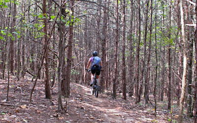
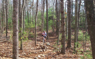
Anglers Ridge Mountain Bike Trail
 Anglers Ridge Park, Danville
Type of Trail: Multi-Use
Length: 25 miles
Trail Head(s) Directions:
The Anglers Ridge Mountain Bike Trail can be accessed from Anglers Park on Northside Drive. This system offers over 25 miles of mountain bike trails with a variety of challenges. Trails vary from beginner to expert providing multiple experiences for each difficulty. Choose your own journey, long or short, by riding a single trail or a combination. Hikers and trail runners are also invited to enjoy the scenic creeks and wooded hillsides of the Anglers Ridge network.
For more info, please visit www.playdanvilleva.com.
 Ballou Park Nature Trail
Ballou Park, Danville
Type of Trail: Multi-Use
Length: .75 mile(s)
Trail Head(s) Directions:
The trail is located below the tennis courts in beautiful Ballou Park, 760 W. Main St., Danville, VA 24541. Ballou Park Nature Trail is .75 miles, making it perfect for an invigorating jaunt into the woods. Interpretive markers, accompanied by the trail brochure descriptions, highlight the flora and fauna found along this forested hillside path.
For more info, please visit www.playdanvilleva.com.
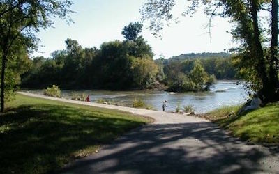
Danville Riverwalk
 Danville, VA
Type of Trail: Multi-Use
Length: 8.5 miles
Trail Head(s) Directions:
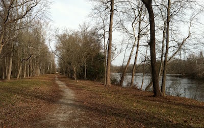
The Danville Riverwalk can be accessed from The Crossing at the Dan, Dan Daniel Park, Anglers Park, and Main Street at the Martin Luther King Bridge. The paved path is designed for shared non-motorized use to include pedestrians and bicyclists. This scenic pathway along the Dan River connects industry, beautiful parks and natural areas. It travels through some of the most important and historic Civil War regions of southern Virginia.
For more info, please visit www.playdanvilleva.com.
Patrick County
 Fairystone State Park Trails (Stuart, VA)
Little Mountain Falls Trail System
Type: multi-use - hiking, biking, horseback riding
Length: 13 miles
Trail Head(s) Directions: Fairystone State Park, Stuart, VA. Take Fairystone Park Hwy. (Route 57)to Fairystone Lake Drive, which takes you into the park.
The Little Mountain trail system is located on the side of the lake where most of the park's amenities are situated. It offers about 13 miles of trails that are intended for multiuse, hiking, biking, and horseback riding.
Stuart's Knob Trail System
Type: hiking
Length: 5 miles
Trail Head(s) Directions: From Fairystone Lake Drive, turn onto Union Bridge Road.The trail head is located near the boat ramp across the lake from Fairystone's swimming area.
The Stuart's Knob system consists of about 5 miles of trails accessible on the far side of the lake near the boat launch. They are for hiking only and range in difficulty from moderate to hard. Several old iron mines may be seen in this area.
DeHart Mountain Trail - DeHart Botanical Gardens (Rt. 58 between Stuart & Meadows of Dan)
 Type: Hiking - Strenuous
Length: approx. 2.8 miles
Trail Head(s) Directions: U.S. 58 West between Stuart and Meadows of Dan, close to Fred Clifton Park. The trailhead is located just off Route 58 near the metal gate. Make sure to sign in on the sheet located in the mail box beside the gate.
The nearly 200 acre garden is on the north side of a mountain range near Fred Clifton Park. Although a private preserve, it is open to the public as a day use facility for hiking a loop trail from the top of the ridge to a waterfall at the base of the mountain. Evidence of a pioneer mountain home is along the way. Hiking to the ridge-top provides a scenic view of Smith River Valley and the only complete view of Rocky Knob anywhere from US 58. The entire loop is strenuous. About 400 species of flora and fauna have been catalogued. A tour guide can be arranged or more information provided by calling.
 DeHart Park Loop Trail- DeHart Park (Stuart, VA)
Type: Walking - Easy
Length: ½ mile
Trail Head(s) Directions: DeHart Park, Wood Brothers Drive, Stuart VA. DeHart Park is just off the Stuart exit on Route 58. The loop trail begins near the tennis courts.
The DeHart Park Loop Trail is a ½ mile paved trail that winds around the swimming pool, tennis & basketball courts, baseball field and playground in DeHart Park.
 I.C. DeHart Trail System- I.C. DeHart Memorial Park (Woolwine, VA)
Type: Hiking, Mountain Biking
Length:15 miles
Trail Head(s) Directions: IC DeHart Memorial Park, Charity Hwy, Woolwine, VA. Charity Hwy (Route 40) intersects with Route 8 near Woolwine Elementary School.
Trails are mostly single track trails with challenging climbs and rocky downhills, kiosk & signs are posted to help navigate. Wildlife & Birding Area: A new asphalt walking trail is a wonderful addition for more physically challenged visitors.
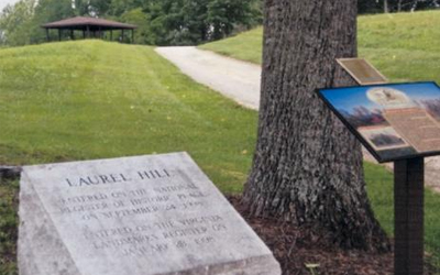 Laurel Hill - JEB Stuart Birthplace (Ararat, VA)
Type:
Length:
Trail Head(s) Directions: Ararat Highway in Ararat, VA
Laurel Hill is located less than a mile from the Virginia-North Carolina border in Ararat. Laurel Hill is owned and Maintained by the J.E.B. Stuart Birthplace Preservations Trust Inc. and welcomes visitors during daylight hours, each day of the week. Information for a self-guided walking tour is provided near the entrance to the property.
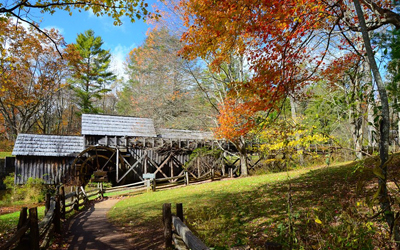 Mabry Mill Trail (Meadows of Dan, VA)
Type: easy, paved walking trail, interpretive
Length: ½ mile
Trail Head(s) Directions: Mabry Mill, Blue Ridge Parkway Milepost 176.2
This is a paved and boardwalk trail. The Mabry Mill Trail takes hikers to the gristmill, sawmill, moonshine display and blacksmith shop. Rustic skills are demonstrated in the summer during the weekends.
Mayo River Rail Trail
 Patrick County, VA
Type of Trail: Multi-Use
Length: 0.5 miles
Trail Head(s) Directions:
The Mayo River Rail Trail is located in downtown Stuart off Commerce Street.The trail head and parking area is located down a short gravel drive across the street from the entrance to the Landmark Center and near Clark Gas & Oil.The trail follows the path of the old Danville and Western Railroad (also known as the Dick and Willie Railroad) along the Mayo River. The trail is a three mile, paved, multi-use trail that is perfect for walking, running, rollerblading, and biking.
Pinnacles Trail (Ararat, VA)
Type: hiking - very difficult, permit required
Length: 2.2 miles one direction
Trail Head(s) Directions: The trail begins past the Pinnacles Hydro Complex, at the end of Kibler Valley Rd. in Ararat, VA. From Hwy. 103, turn onto Ararat Highway, then onto Kibler Valley Road.It can also be accessed via Lower Dam Rd. in Meadows of Dan, VA. You must have a permit to hike this trail; permits can be obtained at either the Hydro Complex or the Lower Dam. The trail is not marked and the terrain is very rugged - make sure to bring plenty of water. Trekking poles are suggested. Due to extreme elevation changes, trail may take much longer than anticipated, so plan to leave early in the day.
 Reynolds Homestead LEAF Trail (Critz, VA)
Type: Hiking/Walking
Length: 1 mile
Trail Head(s) Directions: Upper parking lot at Reynolds Homestead, 463 Homestead Lane, Critz, VA
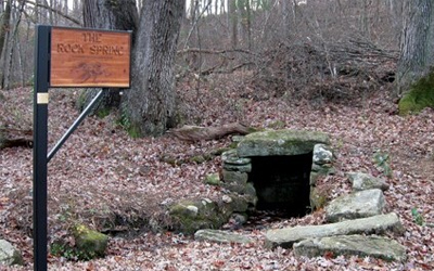
The Reynolds Homestead has created a 1-mile interpretive forest tour trail that combines learning about natural resource use and heritage tourism. The trail is open throughout the year from dawn until dusk and offers seasonal observers an opportunity to experience the changing habitat of native flora and fauna. An informational kiosk is located at the top right of the upper parking lot at the Continuing Education Center. There are brochures, bird sighting records, and more information there. The trail begins just to the right of the kiosk.
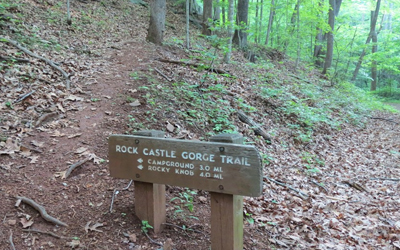
Rock Castle Gorge Trail, (Woolwine, VA & Parkway)
 Type: moderate-difficult
Length: 10.8 mile loop
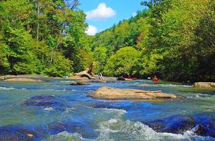
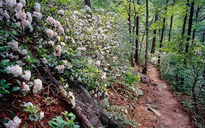
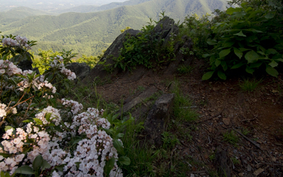
Trail Head(s) Directions: The trail can be accessed via CC Camp Road, off Route 8 in Woolwine VA or at the entrance to the Rocky Knob campground around milepost 167 on the Blue Ridge Parkway. Depending where you start,the trail descends over three miles into the backcountry camping area in the bottom of the gorge. The strenuous and rugged nature of the trail reveal part of the reason this pathway was given National Recreational Trail status. Also, in the springtime to early summer, nearly 200 varieties of wildflowers are visible along the trail area. The rest of the trail is a 7.3-mi ascent back out of the gorge on the return trail. You'll see tunnels of rhododendron and other thick mountain foliage, a splashing stream, and high open meadows. The entire loop is 10.8 miles and the elevations range from 1,700 to 3,572 ft. A few small historic structures are visible along the trail, including a Civilian Conservation Corps camp. There is another trail access with parking at the bottom of the gorge on CC Camp Road in Woolwine. This road is also used to access Rock Castle Creek, a popular fishing spot.
 Rocky Knob Recreation Area Trails
Blue Ridge Parkway Milepost 169
- Hardwood Cove Self-Guided Nature Trail - .8 miles, moderate
- Rock Knob Picnic Loop Trail - 1 mile, easy
- Black Ridge Trail - 3.1 miles, moderate
 Round Meadow Creek Loop Trail (Meadows of Dan, VA)
Type: hiking, moderate
Length: ½ mile
Trail Head(s) Directions: Blue Ridge Parkway Milepost 179.2
Halifax County
Roanoke Canal Trail
 Halifax County, NC
Type of Trail: Multi-Use
Length: 7.8 miles
Trail Head(s) Directions:
The Roanoke Canal Trail is a beautiful recreational biking route from the town of Roanoke Rapids to Weldon. The trail follows one of the country's most impressive and best-preserved early 19-century canals. In addition to the scenery along the 7.8 mile unpaved trail, you can learn about the canal's history at a new museum, housed in the former generator house and office building for the Roanoke Navigation and Power Company. This trail is a great trail for walking, running and biking. Also, there are several places to cast for fishing, so bring the fishing poles!
Mecklenburg County
Coming Soon!