April FSO Paddle the Dan in RoCo
April 5, 2025
5:00 AM - 9:00 AM
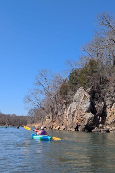
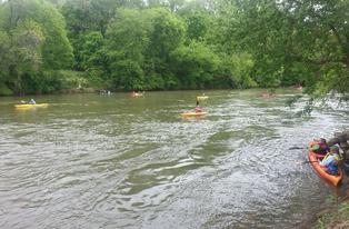
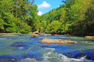
You are invited to participate in DRBA's April 5, 2025, First Saturday Outing (FSO) on a section of the Dan River in Rockingham County for a paddle that will use a new access/takeout location between Mayodan and Eden. Long time DRBA volunteers Mark Bishopric and Tom Taylor with be coordinating this 4.3 mile (2.5 hour) float past Eagle Falls Island and an area known locally as “the Bent” as Spring comes to life along the river.
We'll meet by 9:00 a.m. at the Settles Bridge Access, located off Settles Bridge Road at 290 Dan River Road. Dan River Road intersects Settles Bridge Road just south of the bridge and dead ends at this Rockingham County Public Access, (GPS Coordinates: 36.411096, -79.825494) to unload boats and gear and set the shuttle.
According to Bishopric, “The batteau era sluices and native American fishtraps are readily visible along this stretch of river. This paddle will take out at the Rockingham Gamelands property, a project that started a few years ago with the 1,000-acre purchase by NC Dept. of Wildlife. The paddling access was sponsored Duke Energy. This recently completed concrete access provides good parking, and less steep access than typically available on the piedmont stretches of the Dan River.”
Immediately after the paddle starts, there are 2 ledges, and batteau sluices, at just over a mile downstream when approaching Eagle Falls Island, with one larger ledge and related batteau era stonework for sluices. Another mile downstream, as the river passes tributaries Rockhouse Creek and Roach Creek, “Reese’s Rock” jumps out of the river on the right-hand side. After a few more batteau sluices and 1.5 miles downstream, we will enter the “NC Gamelands” property bordering the south side of the river and reach our takeout point.
At normal water levels this section offers mostly calm waters and Bishopric considers this stretch of the river “novice friendly with one small drop as the river passes Eagle Falls Island.
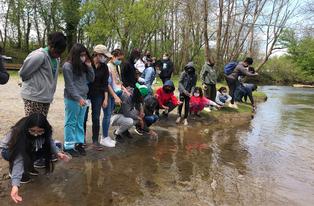
Along with natural ledges, paddlers will pass V-shaped fish traps, used for centuries by Native Americans and European settlers to channel fish into nets or baskets during their annual spawning runs.
After loading boats at the Gamelands access, participants will truly be in the center of Rockingham County, depending on the participants route home, you are 5-8 miles away from Eden, Madison, Mayodan, Reidsville or Wentworth and you may enjoy having lunch or visiting a site in these communities. Visit https://www.visitrockingham.com/ for more information.
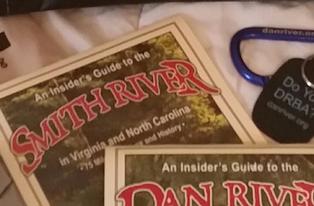
Additional interesting facts about this river section's history, culture, and nearby attractions are found in Maps 51 – 52 of DRBA's publication, "An Insider's Guide to the Dan River in North Carolina and Virginia," available at ShopDRBA. https://www.danriver.org/support-drba/shop/shop-our-products
Participants in the outing are asked to provide boat and paddles, life jacket, lunch and water, and to dress in layers of artificial (quick-drying) fabric or wool. All participants must sign a waiver prior to the event.
BE SAFE OUTDOORS!
Be sure to check DRBA's safety tips for hiking and paddling before you head out for an outdoor adventure! The water will still have a winter chill in early April.
DIRECTIONS:
From Mayodan (from US220) To reach the Settles Bridge Access (US 220 at US 311) exit onto US311 and go east (towards Eden) and proceed to the 1st light after the Walmart shopping center (at Settles Bridge Rd & airport sign) and go south towards the Dan River. After crossing the river bridge, take the 1st turn (Dan River Rd) to the left. The access is at the end of the road on the left. If the parking lot is full when you arrive, please wait, we will be lining up cars along river road for the shuttle to the takeout as participants arrive, are unloaded and ready to go to the Gamelands takeout.
From Eden:
(from NC 14) To reach the Settles Bridge Access (NC 14 at US311) exit NC 14 and follow US 311 west (towards Mayodan) until the 3rd light(airport sign), making a left turn onto Settles Bridge Rd, proceeding south to the Dan River. After crossing the river bridge, take the 1st turn (Dan River Rd) to the left. The access is at the end of the road on the left. If the parking lot is full when you arrive, please wait, we will be lining up cars along river road for the shuttle to the takeout as participants arrive, are unloaded and ready to go to the Gamelands takeout.
From Reidsville/Wentworth:
Proceed from Reidsville to Wentworth, joining HWY 704 west (towards Madison) and continuing through Wentworth, just outside of Wentworth, and crossing Rockhouse Creek, make a right onto Settles Bridge Road. Proceed north on Settles Bridge Road, approximately ¼ mile before the river/bridge, make a right turn, then immediate left turn onto Dan River Road. The access is at the end of the road on the left After crossing the river bridge, take the 1st turn (Dan River Rd) to the left. The access is at the end of the road on the left. If the parking lot is full when you arrive, please wait, we will be lining up cars along river road for the shuttle to the takeout as participants arrive, are unloaded and ready to go to the Gamelands takeout.
For trip information, contact trip coordinators Mark Bishopric at 336-627-6204 or email markb@irvineriver.com or Tom Taylor at 336-402-6100.
Outings and meetings of the Dan River Basin Association are open to the public without charge.
DRBA is on MEETUP! Sign up for free and never miss a DRBA outing!