Hike the Jamison Mill Trails- Nov FSO
November 2, 2024
9:00 AM - 1:00 PM
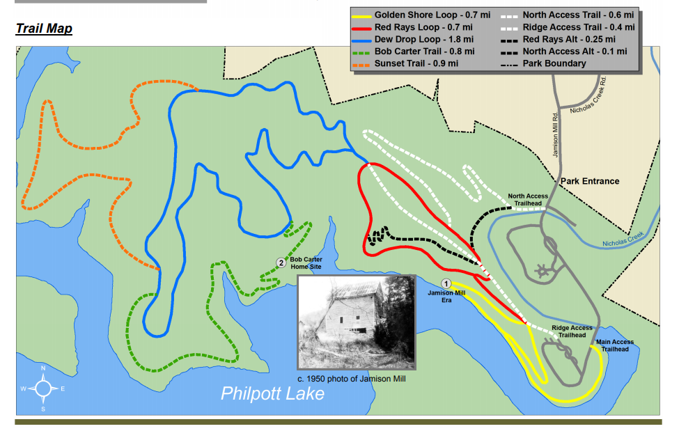
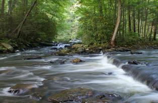
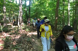
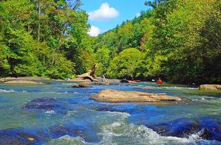
DRBA invites you to enjoy a fall hike at Jamison Mill Park on November 2, 2024. Meeting by 9:00 am at 2000 Jamison Mill Road, Henry, VA (GPS: 36.849672, -80.064285), Google Maps, hikers will experience about 4 miles of the 6 miles of loop trails available within the park. The hike is rated moderate with some short steeper sections as the trails traverse wooded ridges interspaced with views of Philpott Lake.
About the Park
Jamison Mill Park is named after the mill that was located nearby before the construction of Philpott Dam. Built by Thomas Fleming “Flem” Jamison in the late 1800’s, Jamison Mill was a water-powered mill where grains, such as corn and wheat, were ground into mela or flour. The mill was a place of social gathering and remained in operation until about 1949 when the residents of the Jamison Mill community had to be vacated to make way for Philpott Lake.
Located near the mill were two general stores, a blacksmith shop, a stave mill, a cannery, and a sawmill. Homes located near the mill included those of Bob and Lucy Carter, Johnny and Mollie Carter, and Henry and Mollie Ruth Mullins. Two interpretative stops along the trail bring to life the rich history of the community that lived in the vinicity of the mill during the early to mid-1900’s. These stops, which include the original home site of the former miller, Robert “Bob” E. Carter, and a brief history of the “Jamison Mill Era”, recall the memories of those who made a home in these rural Virginia mountains.
What to expect:
Participants in DRBA’s outing are asked to bring lunch and water. Dress in layers of synthetic fabric or wool, wear hiking boots or walking shoes, and be prepared for wind or rain. If desired, bring a walking stick or poles. All participants are asked to sign a waiver.
Directions to Jamison Mill Park:
Service is spotty, download your directions before leaving.
Google Maps
From Roanoke, VA: Take 220 S. When you reach the intersection of 220 S and Sontag Rd (SR 619) in Rocky Mount, go about another 10 miles, then turn right onto Henry Rd (SR 605). Go 9.2 miles, then turn left at Nicholas Creek Rd. Go 1.6 miles, then turn left at Jamison Mill Rd. Go 0.1 miles to park entrance.
From Greensboro, NC: Take 220 N. Once you pass through Ridgeway, merge onto 220 N toward Roanoke. Go about 19.4 miles, then turn left onto Henry Rd (SR 605). Go 9.2 miles, then turn left at Nicholas Creek Rd. Go 1.6 miles, then turn left at Jamison Mill Rd. Go 0.1 miles to park entrance.
From Rocky Mount, VA: Take 40 W for about 14 miles, then turn left onto Henry Rd (SR 605). Go 2.6 miles, then turn right onto Jamison Mill Rd. Go about 2 miles to park entrance.
About DRBA
Outings and meetings of the Dan River Basin Association are open to the public without charge. For more information about the outing, contact Wayne Kirkpatrick,wynbtyk@embarqmail.com or 540-570-3511. For information about the Dan River Basin Association, visitwww.danriver.org.